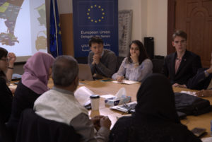
Amman – The 4-day workshop was designed as a training of trainers. It started out with a review of the underlying methodology to ensure all partners were on the same page as to how the data was collected, how to analyse it, and what it could and could not tell us due to the approach chosen. The focus of the workshop was then brought to how to plan and conduct joint analysis processes and ensure that its outcomes effectively inform city / neighbourhood action planning, empowering profiling partners to lead these efforts with local partners in the different cities in Yemen. It introduced the participants – colleagues from iMMAP and UN-Habitat – to the concept of joint analysis and walked them step-by-step through the process.
Importantly, to better understand how parts of a city might have been affected in different ways by a crisis, we need to understand its spatial divisions. This is a critical aspect not just for the joint analysis process but also for programming and development planning, to better inform and tailor actions to the needs of each area as well as those of the people living within them.
As a matter of fact, examining urban focus areas (UFA) and agreeing with profiling partners on the level of analysis (i.e. where to draw the boundaries for the purpose of data collection, analysis and use) is a critical step in a profiling that must come early on in the process. Different sources and methods can be used to help understand what these areas are, such as satellite imagery, road maps, infrastructure built by service providers, qualitative information, and context-specific knowledge contributed by partners.
During the workshop, we built on the urban focus areas that partners had agreed upon in the initial stages of the exercise, to map out how each urban pillar performed in each area of the city. This exercise is usually done by sector and together with relevant experts (such as on WASH, population dynamics, housing / land / property, etc.) within the different profiling partners. We used a fishbone diagram – a simple tool which has proven to be highly effective in our profiling work – to contextualise the preliminary findings and better understand the potential root causes and correlations.
Excerpt from news item published earlier by JIPS on: https://www.jips.org/jips-news/a-training-of-trainers-to-feed-into-the-urban-profiling-in-yemen/


